Maps
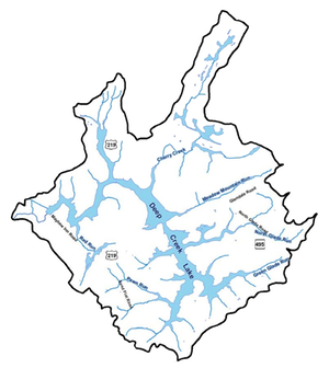
The Water Appropriation Permits of the Deep Creek Lake Watershed
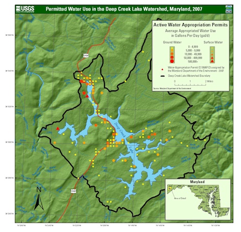
This map shows the locations of permitted water use in the Deep Creek Lake watershed. This map is dated 2007. Note that all but five (5) are for wells (groundwater). One of the five is discharge through the hydro-electric facility.
This map is courtesy of the USGS
You can download the full-size of this image here: ![]()