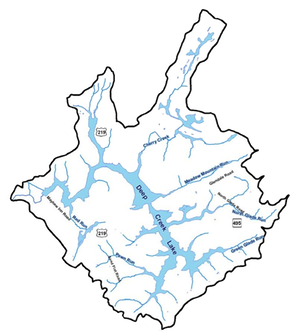
Deep Creek Lake Bathymetric Data
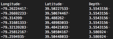
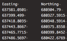
In the spring of 2012, over an 8 day period, Richard Orrt of DNR conducted a bathymetric survey of Deep Creek Lake. This resulted in over 600,000 data point sets of latitude, longitude and depth. A more detailed description and results for many coves and the lake are given on the deepcreekanswers.com website. Below are 7 files of processed data with depth at many latitude/longitude positions. Click on the links to download them. The following is an image of the first few records of one of these files:
- 2012-April 12 Measurements
- 2012-April 13 Measurements
- 2012-April 16 Measurements
- 2012-April 17 Measurements
- 2012-April 19 Measurements
- 2012-April 20 Measurements
- 2012-April 21 Measurements
A sample of the data is shown in the image below.
The following pdf file compares the 2462 line with the lake outline version (original source uncertain) that the County provided for the bathymetric work documented on the deepcreekanswers.com website. The 2462 line is in red. On close examination one may observe that the 2462 contour contains the County contour labeled as "Debbie's Contour."
Resources:
- Most of the reports from which this website's data have been extracted can be found on the document archives of the Deep Creek Watershed Management Plan work.