Maps
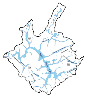
The Bathymetric (water depth) Map of Deep Creek Lake
The U.S. Geological Survey (USGS) collected about 90 miles of bathymetric data in the fall of 2007 and summer of 2008, consisting of nearly 140,000 points. The measurements were made with a 24-ft (foot), aluminum-hull, work boat equipped with a Lowrance LMS480 Fathometer and a global positioning system (GPS) enhanced with a wide-area augmentation system (WAAS). The result of their work is shown below, at a section of the lake near the dam. Each point shown on the map in the lake is a depth in ft.
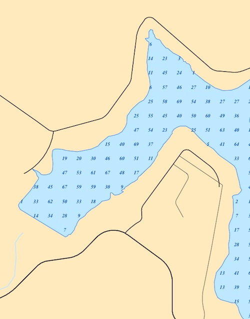
To see the actual values for the whole lake one has to download the full map here: ![]()
In April of 2012 the DNR did a much more comprehensive assessment of the lake, including a new bathymetric map. The preliminary result will probably be available sometime this summer; a final report is scheduled for the spring of 2013.