


Garrett County Geology Map With Additional Contour Lines
Superimposed on this map are several contour lines that indicate possible areas of interest to groundwater influence to Deep Creek Lake, and hence important for assisting in defining an exclusion zone for drilling gas from Marcellus Shale.
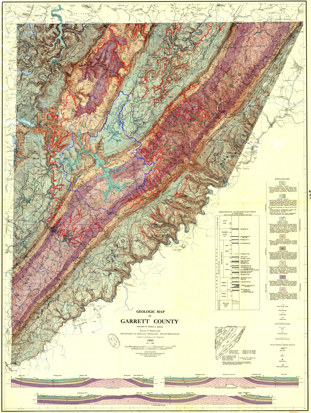
The contours are superimposed on the 1953 geology map of Garrett County. The blue lines are the surface watershed boundary, the red lines are the subsurface drainage area above elevation 2460, and the green arrows are inferred subsurface flow directions from the geologic map.
You can download the full-size pdf file of this map here (its a large, 28.3 MB): ![]() (28.3 MB)
(28.3 MB)